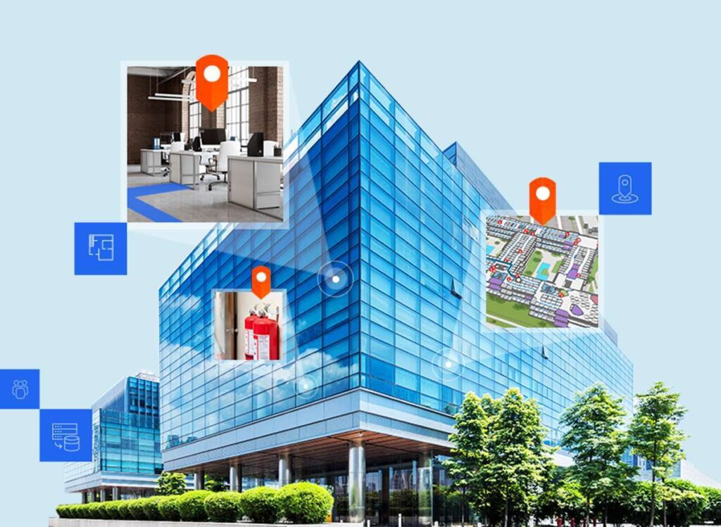
ArcGIS Indoors enables your organization to build an indoor geographic information system (GIS) and put the power of indoor mapping, wayfinding, and space management software into everyone’s hands. With three license levels available, ArcGIS Indoors Pro, Indoors Maps, and Indoors Spaces, your organization can consolidate your asset and space information into a single place, the indoor map, and provide easily accessible web and mobile apps, for location discovery, wayfinding, room reservations, and space planning.
ArcGIS Indoors is the core technology that we use for indoor positioning systems and indoor space solutions.
geoConvergence has earned Esri’s Indoor GIS Specialty designation in recognition of our knowledge and expertise in indoor mapping for use in creating connected workspaces. ArcGIS Indoors can be used to map and analyze the interiors of office buildings, warehouses and other structures for a variety of commercial and government purposes.
Initial Operating Capability Services
geoConvergence has developed a well-defined and proven process of getting your organization up and running.
Conduct Kick-Off Meeting
Implement ArcGIS Indoors Environment
Configure ArcGIS Indoors Environment
Conduct Technical Transfer
Conduct Go-Live Workshop
Provide Follow-on Support
Floorplan Data Conversion Enablement Workshop
geoConvergence organizes and conducts a series of workshops to enable your team to convert CAD/BIM data into the Indoors Information Model.
Conduct Kick-Off Meeting
Check and Clean CAD/BIM Data
Convert CAD/BIM and QA/QC
Review Data Model Output, Schema, and POI Creation
Review Network Creation Steps and Review Network Details
Test Network and Address Issues
Review POI and Symbology
Review Symbology and Publish Map
Test Application and Map
Final Review and Workshop Conclusion
Extend ArcGIS Indoors with Indoor Positioning Systems
geoConvergence extends the Indoors platform by developing custom widgets and also offers a full indoor positioning solution that includes Bluetooth beacon installation.
“Indoor positioning systems solve the ‘last mile’ navigation challenge, bridging the gap between outdoor and indoor worlds.” Jack Dangermond, Esri founder and president
Custom Widgets
Bluetooth Beacon Installation
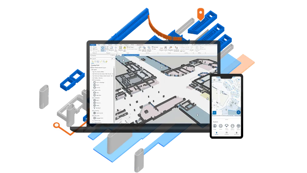
ArcGIS Indoors Pro
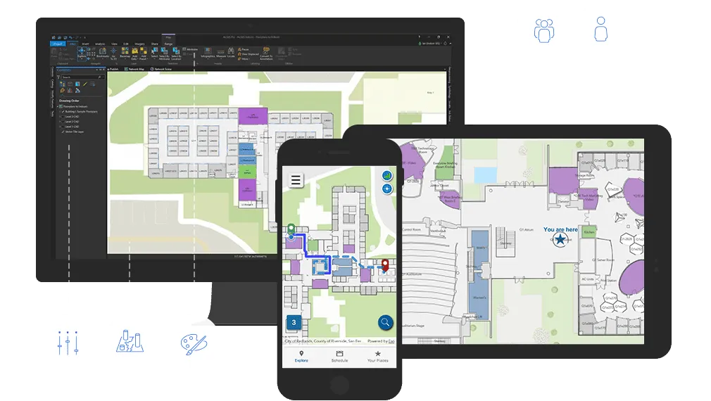
ArcGIS Indoors Pro is an extension for ArcGIS Pro that provides tools for combining various indoor datasets and creating and sharing floor-aware, indoor maps.
ArcGIS Indoors Maps
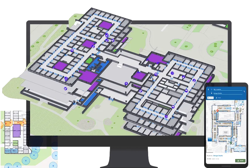
ArcGIS Indoors Maps allows you to put your indoor maps into everyone’s hands in your organization. The Indoors Viewer and Kiosk web apps, along with Indoors Mobile, enable location discovery and wayfinding, with real-time navigation possible with the addition of ArcGIS IPS.
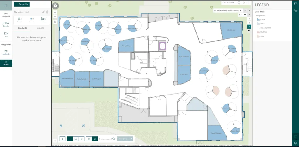
ArcGIS Indoors Spaces
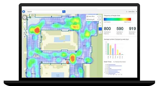
ArcGIS Indoors Spaces extends the capabilities of ArcGIS Indoors Maps with space management software. With the Indoors Space Planner web app, understand how space is used, assign or reassign space, and enable space reservations and office hoteling.
Take Your Projects Further with our
Expert GIS Services
Connect with us today to drive smarter decisions with GIS solutions.