
geoConvergence Partners with Esri on Landmark Digital Twin Project

From point cloud to digital twin: geoConvergence’s mobile LiDAR technology creates comprehensive indoor mapping solutions for healthcare facilities. geoConvergence Partners with Esri on Landmark Digital Twin Project Partnership Delivers Scalable Indoor Mapping Solution for Healthcare Campuses Nationwide Bloomington, Indiana – December, 2025 – geoConvergence, a leader in indoor geospatial solutions, announced a strategic partnership with Esri to deliver comprehensive digital twin technology for a large healthcare campus. The landmark project, currently underway, establishes a scalable framework for healthcare facility modernization that can be replicated across medical centers nationwide. The engagement encompasses +200 buildings totaling over 2.5 million square feet of complex healthcare infrastructure. Using advanced mobile LiDAR scanning and machine learning-powered asset extraction, geoConvergence is creating a comprehensive digital twin that integrates indoor navigation, asset management, and capital planning capabilities on the ArcGIS Indoors platform. The system captures both high-resolution 3D point cloud data and 360-degree panoramic imagery, creating a detailed as-built record of current facility conditions. Modernizing Healthcare Infrastructure The scale and complexity of this engagement reflects the modernization challenges facing aging healthcare infrastructures. With buildings spanning decades of construction and multiple architectural eras, the campus presents the full spectrum of facility management challenges—from space optimization and asset tracking to emergency response planning and accessibility compliance. By developing standardized workflows that combine high-precision spatial data capture with AI-powered processing, geoConvergence and Esri are establishing a framework that can be deployed across healthcare facilities nationwide. The mobile LiDAR approach captures complete facility conditions in weeks rather than the months required by traditional survey methods, while machine learning algorithms accelerate data processing—transforming raw scan data into actionable facility intelligence. A Single Source of Truth for Facility Operations The resulting platform delivers multiple capabilities: real-time indoor wayfinding with ADA-accessible routing for patients and visitors, facilities management tools for maintenance planning and asset tracking, space utilization analytics to optimize building usage, and capital planning data to inform infrastructure investments. All applications draw from a centralized spatial database, ensuring consistency across departments. This centralized approach integrates with existing facility management systems and workflows. By establishing an authoritative spatial dataset, the campus gains a single source of truth for facility information—eliminating data silos and enabling coordinated decision-making across departments. This data governance model ensures long-term sustainability and positions the facility for future technology integration. About geoConvergence Founded in 2004, geoConvergence is a GIS consulting firm specializing in indoor mapping and digital twin solutions for commercial, federal, education and healthcare clients. As an Esri Gold Business Partner with Indoor GIS and Federal Small Business Ready designations, we combine mobile LiDAR technology with GIS expertise to deliver precise spatial data for facility management, wayfinding, and capital planning. geoConvergence serves organizations nationwide requiring secure, accurate indoor mapping solutions. For more information, visit www.geoconvergence.com
AFRS Provides Enhanced Recruitment Insights with Cloud-Based Geo Mapping Application
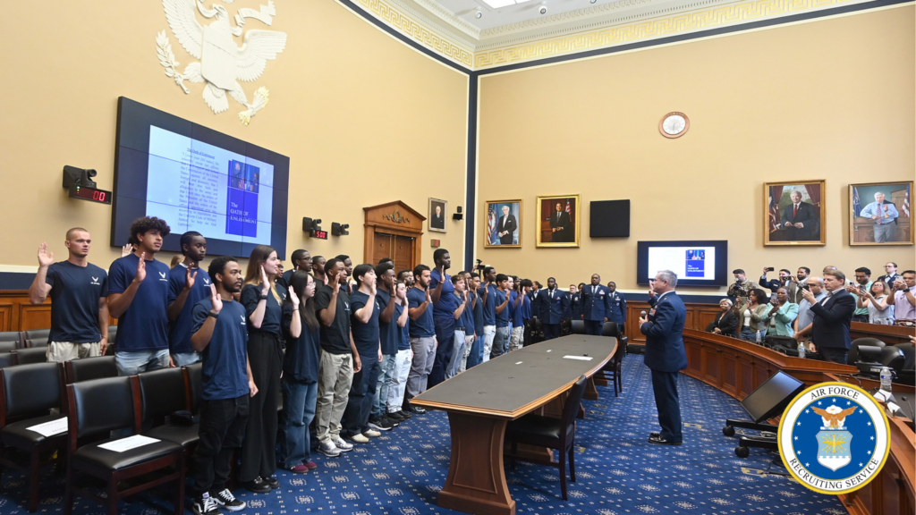
Brig. Gen. Craig McPike, Air Force Recruiting Service deputy commander, hosts a swearing-in ceremony for members of the Delayed Entry Program at the Rayburn Office Building in Washington, D.C., Aug. 15, 2025. (U.S. Air Force photo by Andy Morataya) AFRS Provides Enhanced Recruitment Insights with Cloud-Based Geo Mapping Application Client: U.S. Air Force – Air Force Recruiting Service In 2022, the U.S. Air Force Recruiting Service (AFRS) faced increasing challenges displaying and analyzing geographic-related recruiting data to assist recruiting strategies and operations. Their legacy system, reliant on an outdated on-premise infrastructure, hindered staff and recruiters’ ability to access and use geospatial information for effective recruitment planning and analysis. To address these limitations, AFRS initiated a project to replace its legacy system by migrating to a modern, scalable, cloud-based solution. The modernization aimed to provide AFRS with enhanced data visualization and analysis tools identifying high-potential recruitment areas and other insightful market information. geoConvergence was selected to bring this vision to life. geoConvergence created and migrated AFRS’s new system to Amazon Web Services (AWS) and developed a novel geo mapping application, integrating demographic, economic, and location-based data sets to create a highly available database. By November 2023, the application provided AFRS staff and recruiters access to over 70 layers of geospatial information, including historical recruiting information, population demographics, education levels, and economic indicators. The enhanced database allowed recruiters to identify high-potential recruitment areas and optimize resource allocation based on specific regional characteristics. The project marked the beginning of a new era in delivering data-driven recruiting information for AFRS. THE CHALLENGE AFRS recruits throughout the U.S. and abroad, serving over 2500 recruiters in both the Air Force and Space Force. Their legacy system faced several limitations: Data accessibility: Recruiters could only access the system from a specific AFRS intranet location, limiting field operations. Performance issues: The system experienced frequent slowdowns, with response times for complex queries often too long to be practical for recruiters’ needs. Limited data integration: The system struggled to incorporate external demographic data. Security constraints: Outdated security protocols restricted implementation of modern authentication methods, impeding secure remote access. Scalability challenges: The infrastructure could not efficiently handle peak loads during high-volume recruitment periods. These limitations resulted in: Recruiters spending significant time on manual data compilation and analysis, reducing their efficiency. Underutilization of available demographic data due to the system’s limited capabilities. Limited geospatial capabilities restricted recruiters’ ability to visualize and analyze regional recruitment trends. “geoConvergence’s solution to AFRS’s mapping requirements increased our ability to visualize and analyze the recruiting landscape for both strategic and tactical decision-making purposes.” – Eric Carlson, Market Research Analyst, Air Force Recruiting Service (AFRS) THE SOLUTION geoConvergence developed an all-embracing Geo Mapping Application for AFRS, utilizing AWS technologies and ArcGIS 10.9 at the time (the current version is 11.1). The solution was comprised of: Cloud Migration: Transferred existing infrastructure to AWS cloud Utilized services including S3, CloudFront, and Amplify Implemented Infrastructure as Code (IaC) with CloudFormation for environment management Mapping Application: Developed using ArcGIS JavaScript SDK and Experience Builder Integrated over 70 layers of geospatial information Implemented data visualization and analysis tools User Management System: Built on AWS Cognito Implemented two-factor authentication Designed enhanced user access approval workflows Data Enrichment: Integrated demographic and tapestry data from Esri Business Analyst Automated data processing and updates using custom scripts Enterprise GIS Deployment: Implemented ArcGIS Enterprise in AWS Configured for high availability and performance Maintained 95% SLA using native and custom cloud tooling Security Enhancements: Implemented secure access protocols Utilized AWS security best practices Ensured compliance with Air Force cybersecurity standards The solution modernized AFRS’s recruitment process by providing a secure, cloud-based geospatial analysis platform. Recruiters could now leverage dozens of layers of enriched demographic data to identify and engage with potential candidates more effectively. “Moving our mapping application to an AWS, cloud-based environment alleviated numerous IT access roadblocks. Our recruiters can now reliably access the mapping application anytime, anywhere.” – Eric Carlson, Market Research Analyst, Air Force Recruiting Service (AFRS) KEY FEATURES Over 70 different layers of information for data visualization and analysis Enhanced secure access using AWS Cognito with two-factor authentication Custom experience builder application for Air Force and Space Force recruiters Automated data processing and updates using scripts Serverless, scalable architecture optimizing content delivery performance worldwide IMPLEMENTATION geoConvergence created a completely new mapping tool for AFRS, far surpassing its legacy system by focusing on cloud migration, advancing mapping capabilities, and enhancing data use and access. The implementation centered on: Cloud Migration: Transferred existing infrastructure to AWS Utilized S3 for application deployment Implemented CloudFront for content distribution Leveraged Amplify for application development and deployment Employed blue/green deployment methodology for seamless updates Application Development: Created JavaScript Mapping Application using ArcGIS JavaScript SDK and Experience Builder Developed User Management Application with AWS Cognito Implemented AWS services including RDS, Elastic Cache, and SQS Data Enrichment: Integrated demographic and tapestry data from Esri Business Analyst Developed automated scripts for data processing and updates Security Enhancement: Implemented two-factor authentication with AWS Cognito Designed enhanced user access approval workflows Ensured compliance with Air Force cybersecurity standards Testing and Optimization: Conducted E2E testing using Protractor Performed unit testing with Jasmine/Jest/Karma Executed integration testing, user acceptance testing, load testing, and security testing Deployment and Maintenance: Utilized AWS CodeBuild for code compilation Implemented AWS CodePipeline for automated deployment workflows Established 24/7 Level 1 and Level 2 technical support geoConvergence leveraged its geospatial development and cloud architecture expertise to produce a solution that implemented custom AWS Cognito workflows and multiple MFA methods, including SMS authentication. The team worked hand-in-hand with AFRS personnel throughout the project, incorporating feedback and making iterative improvements to ensure the solution met evolving needs and requirements. “AFRS’s collaboration with geoConvergence has created a mapping application meeting the specific needs of our recruiting force. We’ve continued to enhance the tool based on feedback from our users and suggestions from geoConvergence.” – Eric Carlson, Market Research Analyst, Air Force Recruiting Service (AFRS) RESULTS AFRS’s on-line mapping application transformed how recruiters visualize and analyze the recruiting
geoConvergence at the 2025 Esri Federal GIS Conference

geoConvergence is proud to announce our participation in the Esri Federal GIS Conference 2025, the premier event for federal GIS professionals. As an Esri Gold Business Partner with Federal Small Business Ready designation, we bring two decades of experience implementing enterprise GIS solutions for federal agencies. Our leadership team – Prem Radhakrishnan (President & CEO) and Paul McBride (GIS Practice Director) – will be available to discuss how federal agencies can leverage spatial intelligence to enhance workplace efficiency and facility management. From our award-winning work with the Department of Veterans Affairs to our ongoing federal implementations, we have a deep understanding of unique challenges and requirements of federal GIS initiatives. Join us Wednesday morning at our booth as we showcase our collaboration with GeoCam, the first AI-Native Reality Capture Platform. Together, we’re developing innovative solutions designed to improve the efficiency of government buildings. Our joint focus centers on large portfolio-level facilities, demonstrating how building-level reality capture can automate the generation of ArcGIS Indoors data models and intelligent 3D imagery. During the demo, we’ll show how geoConvergence’s IndoorMa.ps offering processes GeoCam data and imagery alongside the ArcGIS Indoors data model to create a turnkey, scalable approach allowing Federal customers to build and operate efficient indoor mapping systems. Visit Us: Booth: F10 (Lower Level Concourse) Dates: February 24-26, 2025 Location: Walter E. Washington Convention Center, Washington, DC Join us to explore how our enterprise GIS expertise, indoor mapping solutions, and innovative partnerships can support your agency’s mission objectives. Whether you’re looking to optimize facility operations, enhance workplace efficiency, or implement enterprise GIS solutions, our team is ready to help transform your spatial data into actionable intelligence.
IndoorMa.ps: A SaaS/PaaS platform designed exclusively for Indoor Mapping (Series Part 1)
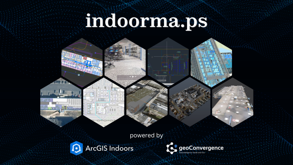
Indoor spaces hold significant potential for optimization, yet they also present unique challenges for organizations striving to enhance safety, efficiency, and utilization. In this first installment of our series on IndoorMa.ps, we introduce you to our groundbreaking SaaS/PaaS platform and its core capabilities. IndoorMa.ps, developed by geoConvergence, addresses these challenges with an accessible, scalable, and rapidly deployable SaaS/PaaS platform. As the first installment in our series, we’ll explore how through this dual approach, organizations can adopt a complete solution with licensing and hosting, or leverage their existing ArcGIS Indoors licenses with our hosting platform. Powered by Esri’s ArcGIS Indoors technology and backed by over two decades of GIS expertise, IndoorMa.ps allows organizations across industries to achieve unparalleled indoor spatial intelligence without the cost and complexity of traditional solutions. This flexible model ensures indoor mapping solutions are accessible to organizations regardless of their existing infrastructure. Whether starting with LiDAR scans or existing CAD/BIM data, organizations can quickly transform their spaces into interactive indoor digital environments hosted securely in the cloud. Offering powerful yet intuitive tools, IndoorMa.ps allows organizations to implement indoor mapping with minimal setup time or resource demands. IndoorMa.ps is also your one-stop shop for indoor mapping services, for data conversion, scanning services and more using our intuitive service request model. Our indoor specialists will provide quick assessments and quotes allowing you to purchase these requests and follow the service activity from your IndoorMa.ps dashboard. Key Features of IndoorMa.ps Rapid Deployment IndoorMa.ps can deploy indoor mapping environments in as little as one week when using existing spatial data, offering immediate use of wayfinding and space management tools. The platform processes standard BIM and CAD files through our data conversion services, maintaining spatial accuracy and building information hierarchies. For facilities without current documentation, our LiDAR scanning captures indoor spaces at sub-10 cm accuracy, generating precise digital basemaps. The data processing workflow supports multiple input formats and automatically configures navigation networks and space boundaries. Users can access their indoor mapping applications through a secure cloud environment, with all spatial data, floor plans, and routing systems ready for immediate use. Efficient Space Management IndoorMa.ps integrates with IoT sensors and Building Automation Systems (BAS) to deliver data-driven space management capabilities: The platform bridges physical and digital environments through an intuitive dashboard, giving facility managers the ability to reduce operational costs and improve workplace efficiency through data-backed space allocation decisions. Transforming Indoor Spaces with Data-Driven Solutions IndoorMa.ps represents a fundamental shift in how organizations approach indoor space management. Through innovative, pre-built CAD and BIM workflows and advanced data processing methodologies, we’re making enterprise-grade indoor mapping accessible and actionable for organizations of all sizes. What once required months of implementation and significant technical overhead can now be achieved swiftly, turning your static building documentation into a dynamic digital advantage that spans space optimization, emergency planning, asset tracking, and reservation management. The future of facility management isn’t just about maps—it’s about creating smarter, safer, and more efficient spaces that adapt to your needs. Our platform delivers exceptional value by combining solutions for space management, emergency response, facility scheduling, and asset tracking into one unified system. Whether you’re a government agency looking to improve public safety or a growing hospital system seeking to optimize patient care, IndoorMa.ps provides the foundation for your facility’s digital transformation. By combining rapid deployment options with proven cost savings, we’re making advanced indoor mapping technology accessible to organizations that previously found enterprise solutions out of reach—delivering a complete suite of facility management capabilities at a fraction of the traditional cost. About geoConvergence geoConvergence, an SBA 8(a) and HUBZone Certified firm, has been a trusted leader in GIS innovation for over two decades. As an Esri Gold Business Partner with Indoor GIS and Federal Small Business specialty designations, geoConvergence combines technical excellence with tailored client support. IndoorMa.ps is our firm’s commitment to transforming indoor mapping into a practical and accessible solution for organizations across industries. To explore how IndoorMa.ps can simplify your organization’s approach to indoor mapping, visit indoorma.ps. Follow us to be notified when the next installment is published.