Our Clients


Veteran's Affairs
The Space Management Support System (SMSS) enterprise application helps VA building management staff manage property invoicing (rent/lease tool) and space utilization (GIS) through reports and workflows. SMSS is an implementation of ArcGIS Indoors that enables the VA to manage office tenants and to run group (division) and vacancy reports. The rent/lease application assistance feature, with invoice automation and streamlined bill management functionality, facilitates more efficient and higher-quality facilities forecasting and cost projections. geoConvergence is engaged to create and maintain spatial data, develop IT solutions, and web application functionality to facilitate data view and analysis, and perform system maintenance on the SMSS databases, servers, and application software.

Baltimore County Public Schools/State of Maryland
geoConvergence is revolutionizing the way the State of Maryland and the Baltimore County Public School system manage and utilize their indoor spaces. geoConvergence will provide a full-scale implementation of ArcGIS Indoors within a combined ArcGIS Enterprise and ArcGIS Online configuration. This ambitious initiative aims not only to enhance the operational efficiency of educational facilities but also to significantly improve public safety within these environments by integrating with local e911 dispatch software.
State of Indiana Geographic Information Office (GIO)
The implementation of ArcGIS Indoors at the State of Indiana GIO’s downtown Indianapolis campus is transforming the way spaces are managed and navigated. By fostering a more efficient, flexible, and user-friendly environment, the project stands to enhance the productivity of government operations and significantly improve the experience of both employees and visitors. Through this partnership, geoConvergence and the State of Indiana GIO are setting a new standard for government workspace management and public service delivery.


State of Indiana GIO
The migration of the State of Indiana GIO’s ArcGIS Enterprise to a cloud infrastructure marked a significant leap forward in the organization’s ability to deliver high-quality geospatial services and analytics. This project not only ensures greater operational resilience and flexibility but also enhanced the GIO’s capacity to support critical decision-making processes across various sectors. By adopting a modern, cloud-based infrastructure, the GIO is well-positioned to meet the evolving needs of its diverse user base, driving innovation and fostering collaboration across the state and beyond. Through this partnership, geoConvergence and the State of Indiana GIO have set a benchmark for the future of geospatial service delivery.

Indiana University
geoConvergence is significantly enhancing the operational efficiency, reliability, and technological advancement of IU’s ArcGIS Enterprise infrastructure. By securing the maintenance and continuous improvement of this critical geospatial platform, IU aims to reinforce its capabilities in facilities management, spatial planning, and decision-making processes across the university’s campuses. The partnership ensures that IU remains at the forefront of leveraging geospatial technology, supporting its mission to provide top-tier educational and operational environments. Through planning, execution, and a forward-looking approach, this project sets a benchmark for excellence in university facilities management and geospatial service delivery.

Air Force Recruiting Service (AFRS)
The AFRS Geo Mapping Application project represents a significant advancement in the use of geospatial technology for recruitment purposes. By leveraging the power of ArcGIS Enterprise and the cloud, AFRS is equipped with a robust tool for detailed analysis and strategic planning. The project underscores geoConvergence’s commitment to delivering high-quality, innovative solutions that meet the specific needs of their government clients, setting a new standard for geospatial application in the recruitment domain.


State of Indiana Secretary of State Election Division
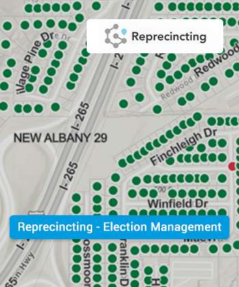
This project represents a significant leap forward in electoral management for the State of Indiana, ensuring greater accuracy in voter precinct assignments, enhancing the efficiency of precinct management, and maintaining compliance with legal requirements. By leveraging advanced GIS technology and a user-friendly suite of applications, geoConvergence has enabled the Elections Division to streamline the reprecincting process, reduce the potential for errors, and ultimately support the integrity of the electoral process in the State of Indiana.

State of Indiana Department of Education
This project represents a significant leap forward in electoral management for the State of Indiana, ensuring greater accuracy in voter precinct assignments, enhancing the efficiency of precinct management, and maintaining compliance with legal requirements. By leveraging advanced GIS technology and a user-friendly suite of applications, geoConvergence has enabled the Elections Division to streamline the reprecincting process, reduce the potential for errors, and ultimately support the integrity of the electoral process in the State of Indiana.

Spring Grove Cemetery
In collaboration with Spring Grove Cemeteries, geoConvergence successfully developed and implemented a comprehensive GIS System, enhancing cemetery management and visitor experience through advanced infrastructure and database design. This solution streamlined the integration of survey-grade CAD files into a unified database, facilitating efficient visualization and analysis of both spatial and non-spatial data. Our custom-built web and mobile application, Plotfinder, revolutionized user interaction by enabling detailed searches of interments by name or location, alongside access to critical information like deceased names, interment dates, and original lot diagrams. Additionally, the application supports real-time management of service schedules and work orders. Innovatively designed tools within Plotfinder, such as GPS-based location services, measurement tools, and interactive navigation, significantly improved operational efficiency and user engagement. The platform also introduced functionalities for managing Mausoleum type buildings, empowering users with capabilities to edit and view units across different floors, thereby exemplifying our commitment to delivering versatile and user-centric GIS solutions.
